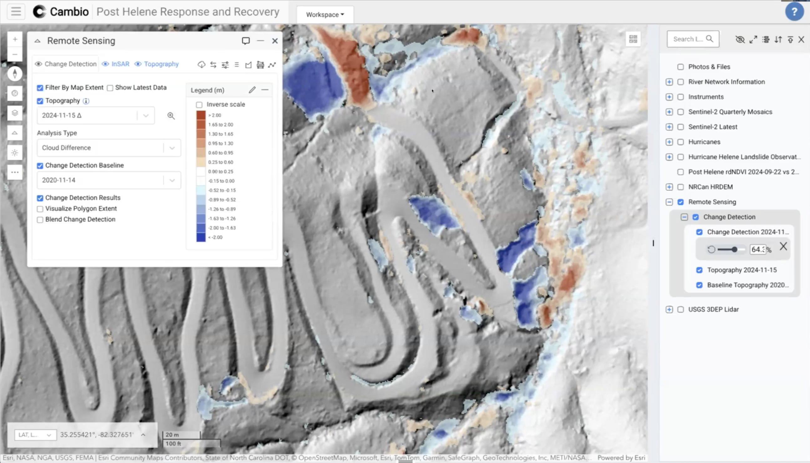
.svg)
Lidar in Action: Disaster Recovery Reimagined
For emergency management professionals, engineers, and geoscientists seeking to enhance their disaster response methodologies.
Key Takeaways:
- Understand the technical advantages of rapid lidar deployment for identifying and measuring ground hazards.
- Learn methodologies for integrating lidar data collection and analysis into emergency response frameworks.
- Examine case studies demonstrating how visualization tools transform complex geospatial data into actionable information.
.jpg)
.jpg)
.png)
.png)