Pipelines

Improve operational efficiency.
Strengthen regulatory compliance.
Prevent geohazard-related failures.
Laptop screen displaying hydrotechnical inspection details for 4 Brother Creek with map view, image attachments, and final calculation results on a monitoring software interface.
Earth sciences play a critical role in preventing geohazard failures and unplanned mitigations.
For over two decades, Cambio™ software has been trusted by more than 35 operators to manage pipeline corridors of all sizes, achieving a 10x lower failure rate from geohazards. These proven capabilities now help operators analyze lidar, InSAR, IMU, instrumentation, and inspection data to keep corridors safe and budgets defensible.
COMMON CHALLENGES
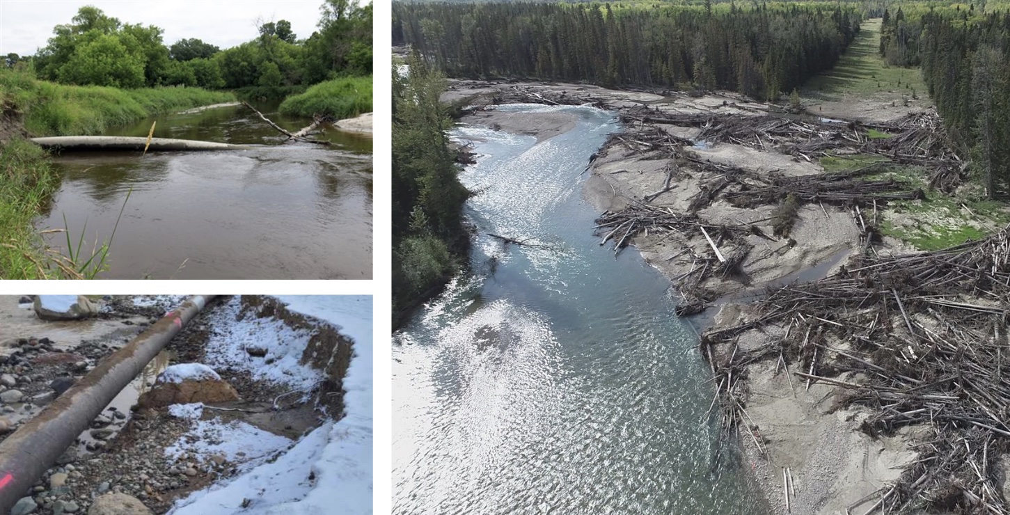
Underutilized geohazard data scattered across multiple systems covering large corridors and asset inventories.
Evolving PHMSA, CER, and other requirements demanding greater transparency and documentation.
Delays in decision making caused by integrity misalignment or stakeholder knowledge gaps.
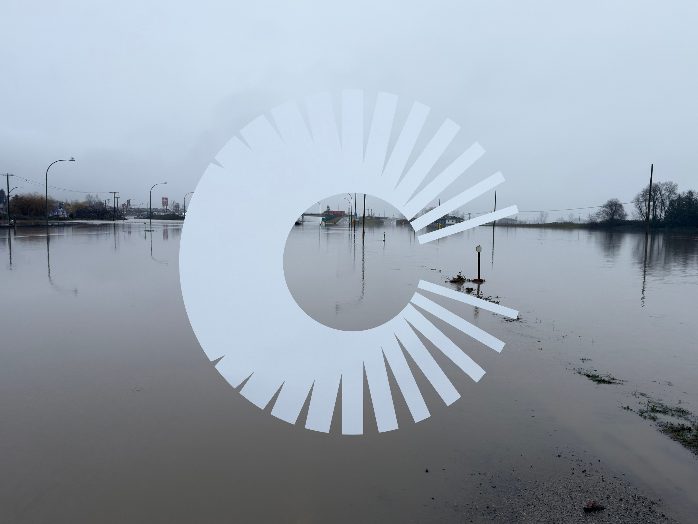
Rising exposure to more extreme events increasing hazard frequency and severity.​
Cambio provides measurability for program effectiveness and operational efficiency
Are you focused on the highest consequence sites in your corridor?
Are you catching slope and hydrotechnical changes early enough to prevent failures?
Can you clearly explain and defend your integrity decisions to senior leadership?
Can you prove compliance across the full network?
Are your mitigation designs being built to spec and performing as intended?
What happens if your key integrity engineer or vendor leaves mid-program?

We take away the guesswork

plus sign symbol
Always know where your highest-risk sites are and how they’re changing
  • Corridor-wide view with lidar/InSAR, IMU, instrumentation & inspection history
  • Hazard and asset algorithms based on decades of pipeline impact
  • Integrated, multi-source monitoring with actionable thresholds for earthquakes, floods, and rainfall events
  • System wide dashboards that pinpoint high-risk sites and track changes over time
plus sign symbol
Compare geotechnical and hydrotechnical risk to other threats on equal terms across all assets
  • Standardized rating criteria and formulas for objective, repeatable Level 1, 2 and 3 assessments
  • Auto-calculated PoF, category, and risk from inspections, sensors, and remote sensing
  • Roll-ups for districts, regions, operation areas, and pipeline systems to target investments where it’s needed most
  • Customizable timing and due date calculations for systematic site management
plus sign symbol
Streamline inspections, coordination, and early detection to make every site visit count
  • Scheduled inspections with due dates driven by PoF/risk assessment
  • Actions, approvals, and attachments in one record
  • Audit-ready records of who did what, when, and why
  • Verification from IMU, remote sensing, and weather overlays to prioritize site visits
  • Before/after change detection to assess stability
plus sign symbol
Turn inertial and inline inspection (IMU/ILI) data into a geohazard early-warning system
  • Detect geohazard interaction by comparing IMU strain features with landslide terrain
  • Spot gradual ground movement with bending strain assessment
  • Integrate ILI findings with hazard and asset inventories for a complete risk picture
  • Automate landslide-related feature identification
  • Use combined IMU/ILI + terrain change data to track run to run change
our RESOURCES
Related Articles
ALL ARTICLES
API RP 1187: Getting Your Pipeline Geohazards on Solid Ground
Landslides don’t check your pipeline schedule before they move—and that’s exactly why API RP 1187 exists.
arrow rightarrow right
IMU Data: A Critical Source of Insight for Pipeline Geohazard Management
Inertial Measurement Unit (IMU) technology is becoming an essential tool in identifying and mitigating geotechnical risks to pipeline infrastructure.
arrow rightarrow right
The Future of Pipeline Geohazard Management: Cracking the Landslide Code with Dr. Corey Scheip
Geohazards like landslides are a major threat to pipelines. Discover how expert Dr. Corey Scheip and Cambio are leveraging cutting-edge tech like lidar and InSAR to detect and monitor these threats, ensuring the safety and integrity of our pipeline infrastructure.
arrow rightarrow right

Unlock every dataset and report to improve operational efficiency, strengthen regulatory compliance and prevent failures.