IMU Data: A Critical Source of Insight for Pipeline Geohazard Management
.jpeg)
Inertial Measurement Unit (IMU) technology is becoming an essential tool in identifying and mitigating geotechnical risks to pipeline infrastructure. From slope failures to ground movements, IMU data offers a detailed and dynamic view of how pipelines interact with the earth over time.
Caroline Scheevel, Engineering Geologist at BGC Engineering, and the Cambio Earth team have developed a structured and scalable method for interpreting and managing IMU data in support of geohazard monitoring. This approach, presented at PPIM 2025 on January 31st, is helping operators extract value from IMU datasets—especially in cases where critical sites have been identified through strain signatures. In fact, more than 50% of BGC’s “critical intervention” sites in 2022 were flagged based on IMU data.
Navigating the IMU Data Challenge
IMU data has emerged as a valuable source of information for pipeline geohazard management. Prior research by Senior Geotechnical Engineer Joel Van Hove demonstrated that over half of critical intervention sites were identified due to IMU signatures alone. However, with its value comes significant complexity.
The vast majority of strain detections—more than 90%—are unrelated to geotechnical hazards, requiring analysts to separate signal from noise. The volume of data generated can be overwhelming: millions of data points across thousands of miles of pipeline demand careful organization and interpretation, particularly when comparing changes across multiple inspections.
The Complexity of Strain Interpretation
Interpreting bending strains from IMU data is far from straightforward. Analysts must accurately locate the strain on a map, assess geomorphic context (e.g., whether a feature is associated with a landslide), and evaluate pipeline alignment relative to the slope. These spatial relationships are then compared to the strain signature itself to determine whether deformation is consistent with external ground movement.
As Scheevel describes, synthesizing this information is a demanding process—often requiring multiple displays to analyze spatial data, historical context, and strain patterns simultaneously. Repeated surveys can further complicate interpretation. For example, a location previously flagged with a 300-foot strain may appear as 275 feet in the next dataset. Without a clear historical record and data management system, it can be difficult to determine whether a re-analysis is warranted, creating inefficiencies and risk.
A Structured Framework for IMU Data Management
To address these challenges, Scheevel and her team have proposed a five-tiered data framework that brings consistency and clarity to IMU data workflows:
- Pipeline attributes – Foundational information about pipeline geometry and construction.
- ILI run information – Metadata related to inspection timing, methods, and conditions.
- Strain reports – Vendor-processed outputs that contain raw strain measurements.
- Strain features – Specific segments of concern along the pipeline, flagged for review.
- Strain inspections – Expert evaluations that interpret strain features in a geotechnical context.
This structured methodology supports reproducible analysis and ensures that data is consistently documented and accessible for future investigations.
An Integrated View is Key for IMU Data Integration
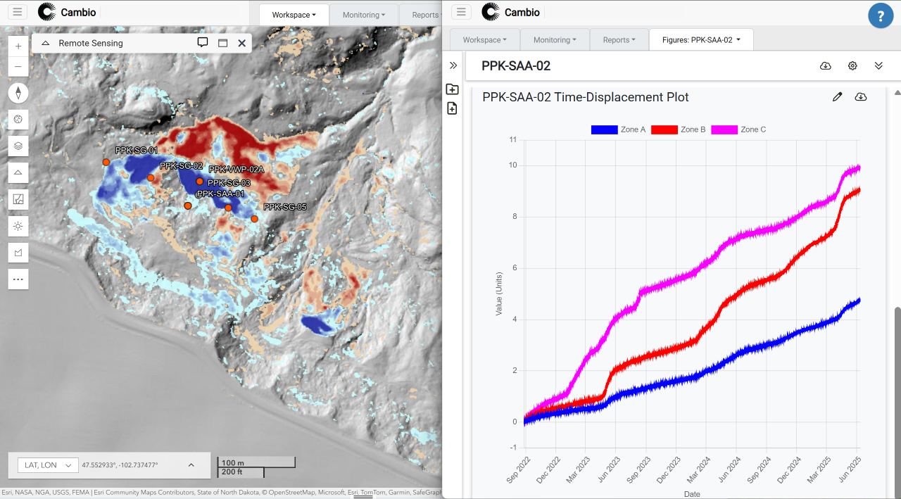
Cambio Earth’s platform supports this framework by providing a geospatially intelligent system for storing, visualizing, and analyzing pipeline geohazard data. Built specifically for infrastructure monitoring, Cambio enables operators to:
- View strain features and contextual data in a single geospatial environment.
- Track strain evolution over time to identify emerging risks.
- Link strain features to external hazard indicators such as landslide zones or ground movement polygons.
- Analyze and compare datasets from multiple inspections.
- Prioritize mitigation measures based on risk-informed decision support.
By simplifying and unifying data access, Cambio accelerates insight generation and enables operators to maintain situational awareness across their networks.
Looking Ahead: Advancing Risk-Informed Decision Making
As the pipeline industry continues to adopt digital tools and advanced analytics, IMU data will play an increasingly central role in risk management. In the near future, we can expect:
- Automated screening tools that adjust to terrain-specific deformation mechanisms.
- Faster, more accurate interpretation workflows supported by intelligent software.
- Integrated historical and current data views for comprehensive hazard assessment.
- Decision-support features that focus operator attention on high-consequence areas.
These innovations will enhance the ability of operators and geotechnical specialists to safeguard critical infrastructure through more targeted and efficient geohazard programs.
Unlocking the Full Value of IMU Data
To realize the full potential of IMU data, operators must adopt structured workflows and digital tools that support high-quality interpretation. Cambio enables teams to manage the scale and complexity of IMU data effectively—transforming raw outputs into actionable intelligence that protects pipeline integrity over the long term.
.svg)

%20Large.jpeg)

.png)