.svg)
Lidar Hosting and Visualization
Securely store and interact with lidar datasets in the Cambio™ geospatial platform. Overlay multiple timepoints, inspect elevation change, and compare with ground truth data such as instruments and inspections.
Lidar Change Detection (LCD)
Identify and quantify differences between sequential lidar scans to detect landslides, settlement, deposition, or bank erosion, as well as earthworks activities such as tailings dam raises, haul road grading, and slope stabilization.
Cambio Landslide Movement Mapping[PREVIEW]
Flag active landslides across lidar change detection to reduce review time and help teams prioritize follow-up inspections.
InSAR Hosting and Interpretation
Securely store and interact with InSAR time series in the Cambio™ geospatial platform to visualize ground displacement trends. Track millimeter-scale movement over time and correlate with field observations and sensors.
Cambio Ground Movement Detection [R&D]
We’re working on models to highlight changes within known hazard areas, helping confirm movement and prioritize response.
Cambio Bank Erosion Characterization [PREVIEW]
Compare high-resolution and historical optical imagery over time to detect erosion along rivers and shorelines, reduce ground surveys, and support proactive intervention and habitat protection.
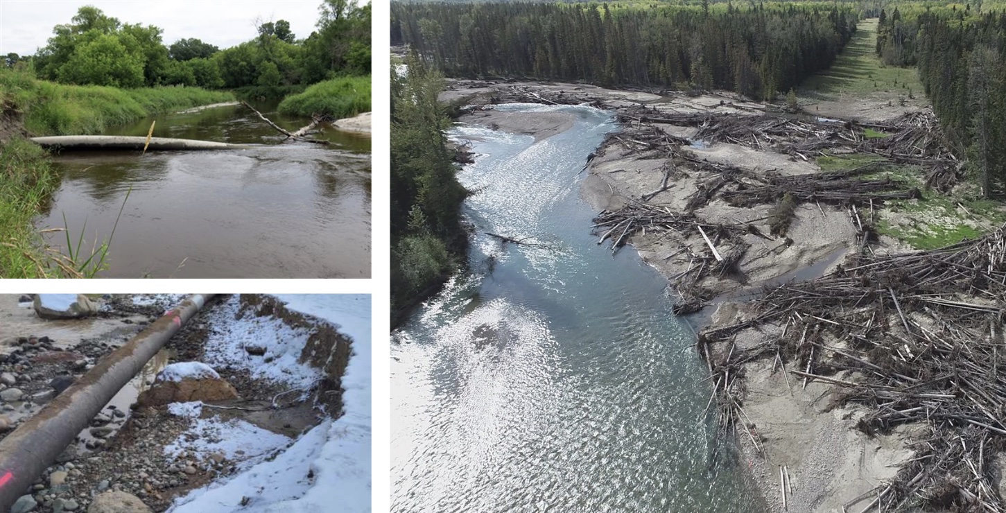
Cambio Water Crossing PoF
Predict key values for pipeline water crossings (including probability of failure, exposure, and scour depth) using watershed, stream, and pipeline characteristics to help prioritize fieldwork, verify collected data, and assess uninspected sites with confidence.
IMU Hosting and Visualization
Securely upload and interact with IMU data in the Cambio™ geospatial platform, aligned to pipe centerline.
Cambio IMU Assessment[R&D]
Detect and categorize strain signatures from in line inspections to help target geotechnical investigations and support pipeline integrity.
%20Large.jpeg)


.png)