.svg)
Maintain a digital twin that connects designs, inspections, photos, and monitoring results to time and place—so progress is tracked and reports are ready in minutes.
- Map-based access to drawings, reports, photos, and forms
- Timeline views of site evolution and construction progress
- Centralized, traceable by structure, time, or team
- Geospatial workspace for clearer visualization and communication
Standardize field data collection to improve quality, reduce errors, and give crews the context of past records at their fingertips for more informed inspections, photos, and testing.
- Mobile forms tailored to earthworks QA/QC and safety checks
- Instant upload of photos, measurements, and test results
- Geo-referenced observations tied to structures and time
- Action-triggered workflows to close the loop faster
Monitor progress in real time to stay on schedule and within spec. Visualize each lift, verify quality, and streamline communication while drone surveys and field tests keep every step documented and ready for review.
- Track lift sequencing and geometry with automated drone-based change detection and survey data
- Link field test and lab results to specs and locations
- Routinely compare design vs as-builts to confirm progress and conformance
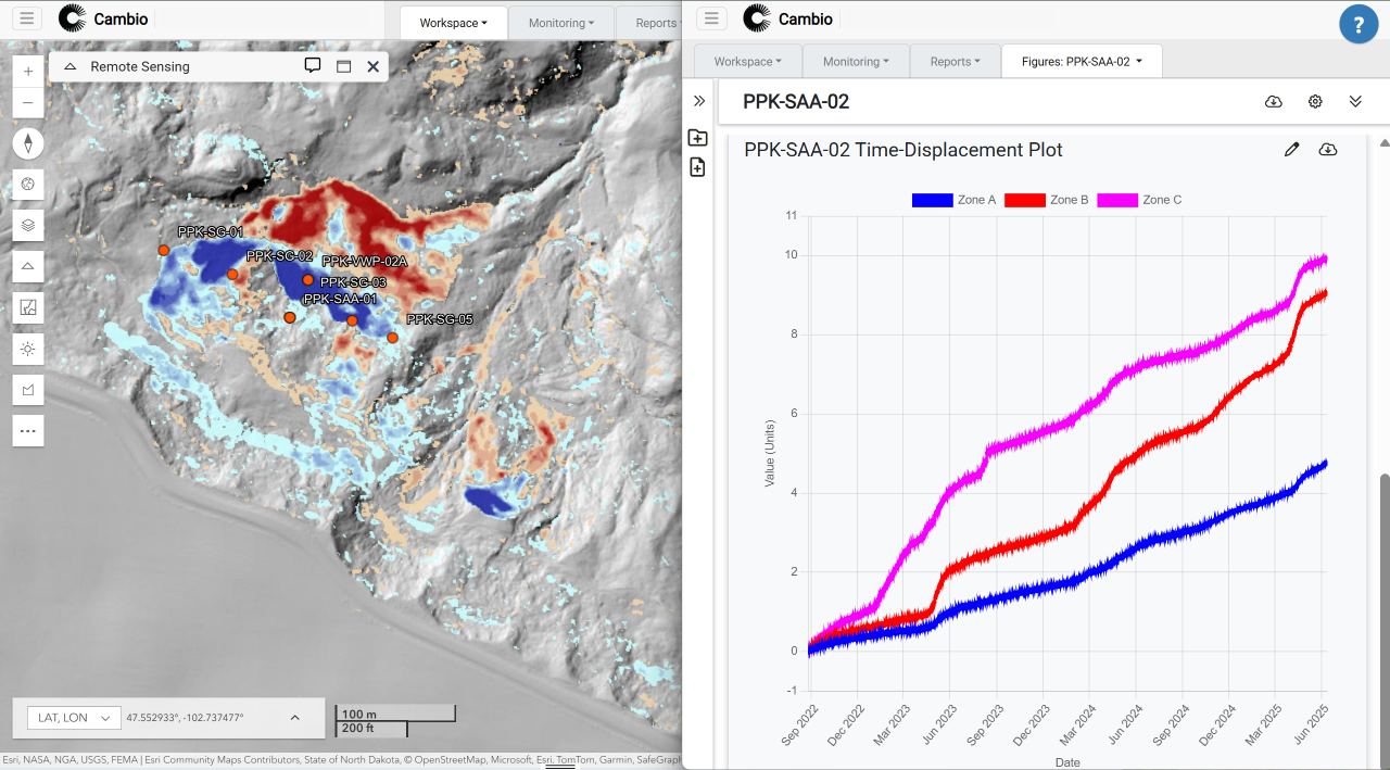
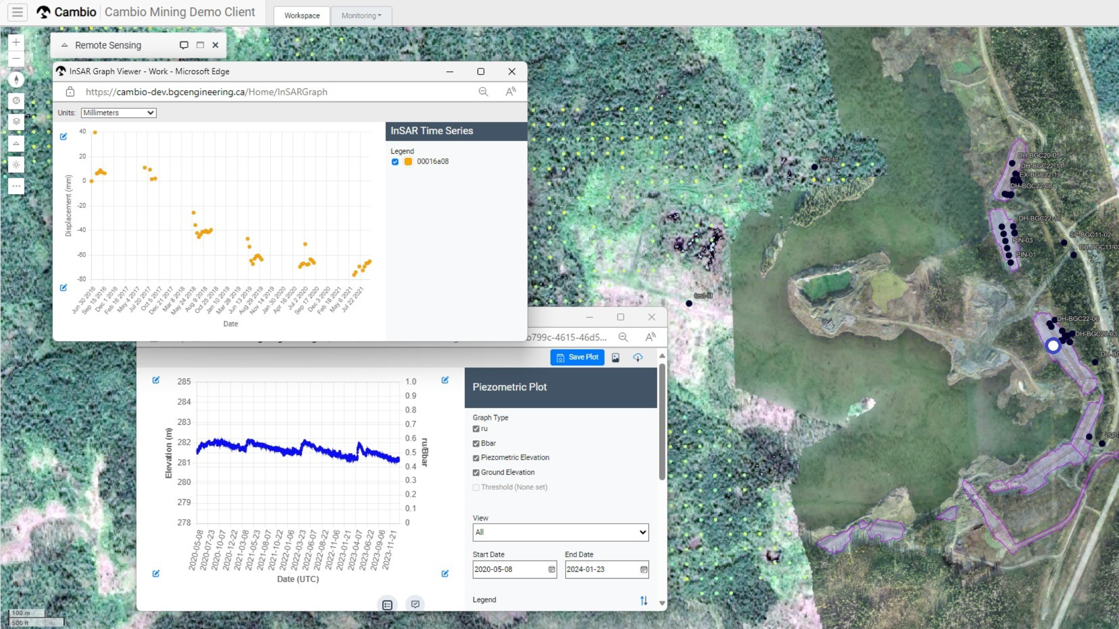
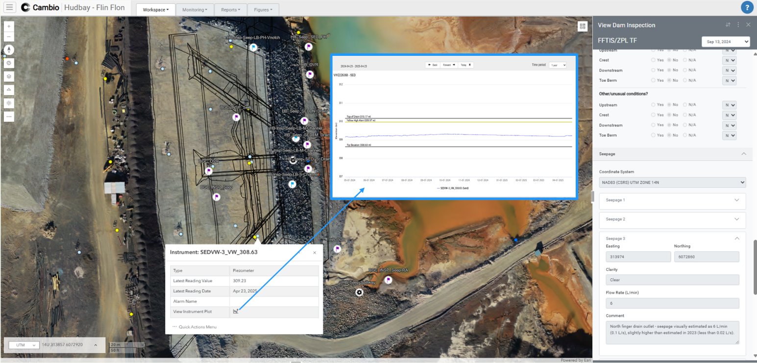
Track surface, subsurface, and environmental conditions to detect issues early, reduce field delays, and accelerate response by combining instrumentation, remote sensing, and weather data with site thresholds.
- Real-time instrumentation data with automated alerting
- Processed photogrammetry, inSAR, and optical imagery
- View monitoring data in context with borehole, geomodels, and designs
- Event-triggered alerts and map-based workflows
.png)
.png)

.png)