.svg)
KEY FEATURES
Shift from reactive to proactive risk management
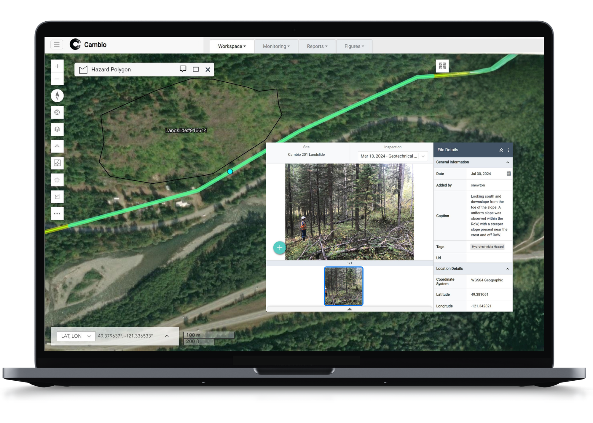
Compare and prioritize sites continuously with system-wide visibility of geohazards and related geo-assets that stay current to keep every site visible, comparable, and ready for action.
- Assisted hazard ID using lidar, satellite imagery, and smart stream networks
- Inspection forms by hazard type
- Photos and files tied to sites and map locations
- Map hazard extents and track changes over time
Calculate risk dynamically and objectively using data from inspections, instrumentation, and remote sensing to justify action or confidently choose inaction, by leveraging all lines of evidence.
- Frameworks with embedded ratings, categories, and timing of next action
- Automated calculations of vulnerability, probability of exposure/impact, probability of failure or risk
- Threshold alerts that notify teams of high-risk conditions
Bring structure and accountability to geohazard programs across entire networks to keep inspections, actions, and decisions organized, reviewed, and recorded.
- Recurring inspection scheduling
- Actions, updates, and files tied to specific hazards
- Approval workflow and audit-ready activity logs
- Dashboards highlight program status, high-priority sites, and monitoring alerts
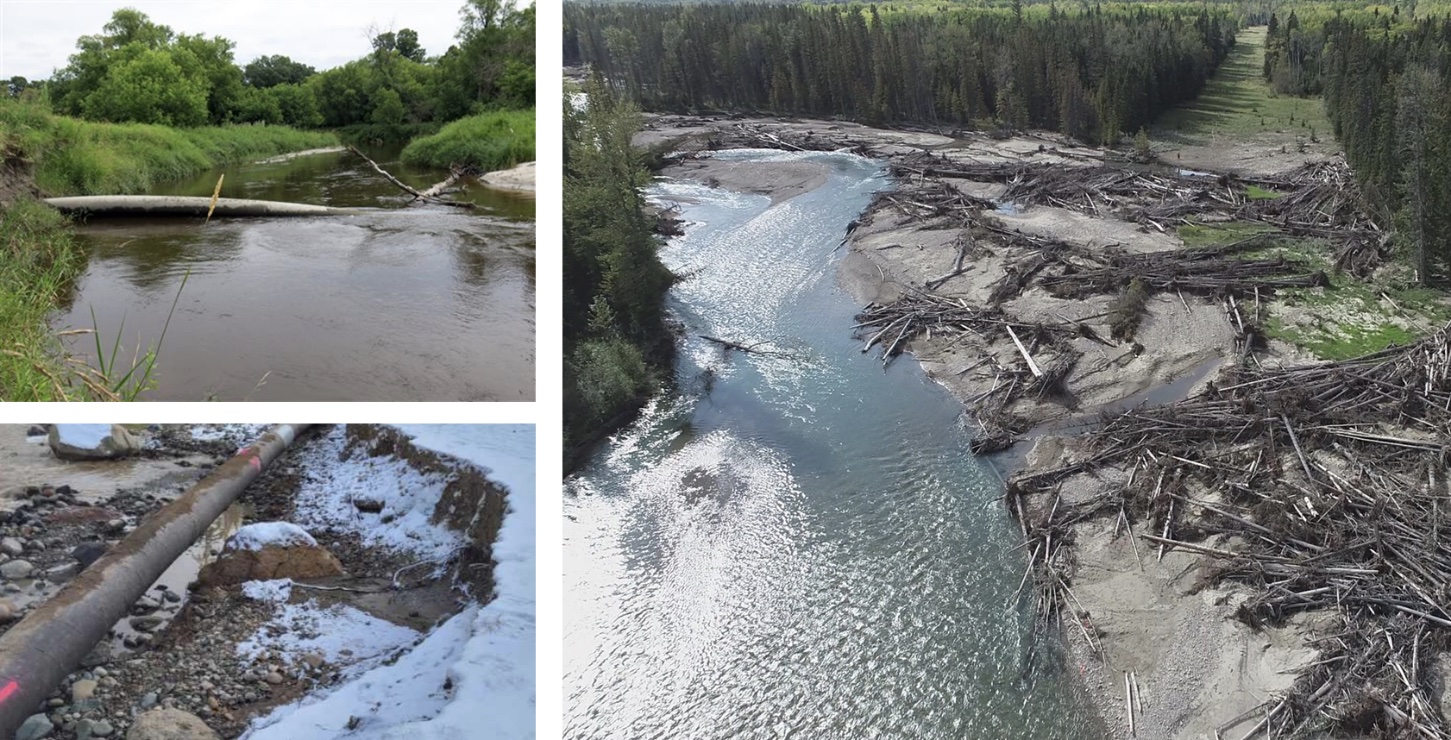
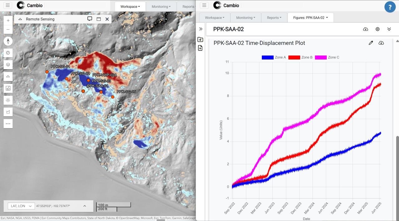
Monitor surface, subsurface, or watershed conditions by analyzing remote sensing, instrumentation, and live environmental data in context to detect change and spot early warning signals.
- Real-time geo-referenced instrumentation data
- Live rainfall, snowpack, streamflow & seismic inputs
- Time-series and rate-of-change alerts
- Lidar and InSAR tools for surface and ground movement
- Event-triggered workflows and 3D terrain viewers

%20Large.jpeg)


.png)