.svg)


What Are We Missing Between the Reported IMU Strain Features?
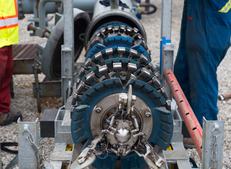
Our latest research asks a complementary question: could machine learning identify landslide-related deformation patterns elsewhere in the full IMU signal?
Moving beyond reported strain features
Our earlier research focused on a machine learning classifier that evaluates vendor-reported bending strain features and prioritizes those most likely to be associated with landslide movement. The latest work takes the next step.
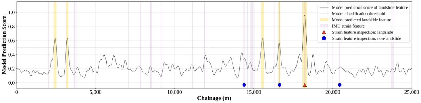
Instead of asking, “Which of these reported features looks like a landslide?”, the full-run scanner asks: “Where along this entire IMU run do we see a pattern consistent with landslide interaction?”
The model moves along the pipeline in overlapping windows, analyzing pitch, azimuth, horizontal strain and vertical strain to produce a continuous indication of potential landslide impact. Because it operates independently of vendor-reported strain features, it can examine sections of pipeline that may fall below reporting thresholds or were never prioritized for review.
Testing more than 10,000 km of IMU data
The data science team tested the approach across approximately 10,200 km of IMU data from 224 ILI runs. The scanner identified 115 of 143 known landslide-interacting strain features, achieving 80.4% recall, while flagging just 249 km (2.4%) of the pipeline for further review.
But perhaps the most interesting result was found at the low end of the strain range. The test dataset contained 83 bending strain features below 0.1% total unformed bending strain, below the commonly used 0.125% reporting threshold for single-run analysis. Three had independently been confirmed as landslide-related using evidence including run-to-run change and field observations.
The full-run scanner detected two of those three using only the spatial pattern in the IMU signal. The sample is small, and more validation is needed. But it suggests that landslide signatures may sometimes be present in IMU data at locations where conventional screening simply isn't looking.
Earlier detection could mean more time to respond
Threshold-based screening has been a practical way to reduce the enormous volume of IMU data requiring detailed review. The full-run scanner points toward a more optimized alternative: screening the entire signal for deformation patterns associated with landslide interaction rather than relying primarily on strain magnitude.
Machine learning has the potential to recognize the shape of a landslide-related deformation signature even when its absolute strain magnitude is relatively low. If that helps identify pipeline interaction earlier in the loading process, operators may gain more time to investigate, monitor and respond before strain progresses to more consequential levels.
Where the research goes next
The full-run scanner remains an R&D capability. Further work is needed to validate detections below conventional reporting thresholds and expand the training dataset beyond the regions and pipeline conditions most strongly represented today. The data science team is also exploring how lidar, construction history and other site context could help the model distinguish landslide deformation from other sources of pipeline bending.
Another direction is run-to-run analysis which is coming soon. Comparing repeat IMU inspections can reveal where bending strain is changing over time. Combining that change detection with machine learning that helps interpret why the change may be occurring could provide an even stronger basis for identifying emerging geohazard interactions.
That is where we're headed: from screening reported features, to finding change between inspections, to ultimately making more of the information already contained in IMU data available to geohazard teams.
Learn more at IPC 2026
Our own Aron Zahradka, Data Scientist Lead at Cambio Earth, will present “Use of Machine Learning to Identify Landslide Signatures in IMU Bending Strain Data” at the 2026 International Pipeline Conference (IPC) in Calgary on September 22 during the 10:30 am-12 pm session. This paper was co-authored by Aron Zahradka, Sarah Newton (Cambio Earth), Corey Scheip, Owen Bunce, Caio Stringari (BGC Engineering), and Jared Kowis (Enbridge).
As well, Sarah Newton, Chief Product Officer at Cambio Earth, will present “Applications of Machine Learning and Artificial Intelligence to Pipeline Geohazard Integrity Management Programs” at IPC on September 25 during the 10:30 am-12 pm session.
.jpg%20(1)%20(1).jpeg)
.jpg)
.svg)

.png)