Instead of scanning LCD datasets manually, teams receive a rapid, defensible starter inventory of likely active landslides —ready for validation, prioritization, and action.
.svg)


.png)
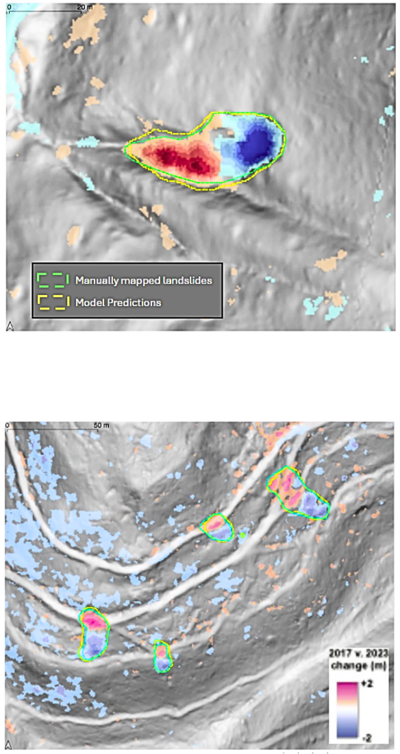
Lidar Change Detection (LCD) reveals where the ground has moved. Landslide Movement Mapping identifies which of those changes areconsistent with landslide activity.
It applies a deep learning–based semantic segmentation model tolidar-derived terrain data and change products.
Detection of landslide-consistent movement signatures tuned for subtle surface expression in complex or vegetated terrain
Pixel-level classification to generate polygons with confidenceattributes
The model was trained on 8,000+ manually mapped landslides from real LCD datasets, representing one of the most comprehensive active landslide inventories assembled for this purpose.
Generate a rapid starter inventory of active landslides across long corridors or large areas
Augment or update inventories of known landslides
Standardize landslide screening across regions and programs
Reduce manual LCD review time across large or remote terrain
Screen for landslide activation following extreme rainfall or earthquake triggering events
Prioritize slopes for field inspection when time or budgets are constrained
Identify new or expanding landslide features not previously mapped
Support risk ranking and mitigation planning

.svg)

.png)