The mining industry’s relationship with data—especially instrumentation data—has evolved dramatically. We’ve gone from craving more data to design and monitor facilities, to having too much data without effective ways to utilize it.
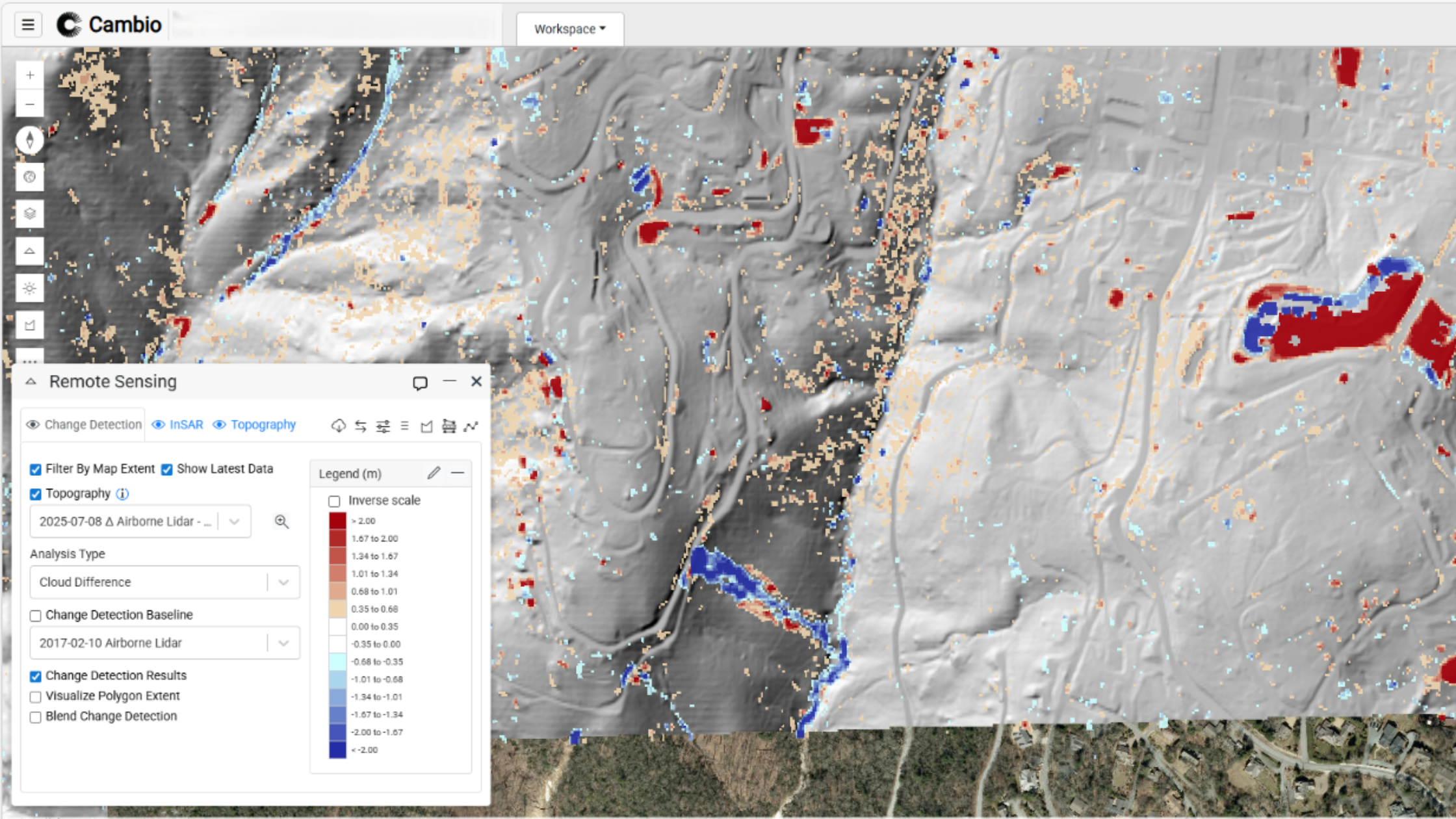
At the 2026 REX (Risk, Economics & Safety Conference) in Orlando earlier this month, Cambio Earth’s Chad Sutherland presented a question many pipeline integrity teams are currently facing: How do we efficiently identify the small fraction of water crossings that represent the majority of geohazard risk?
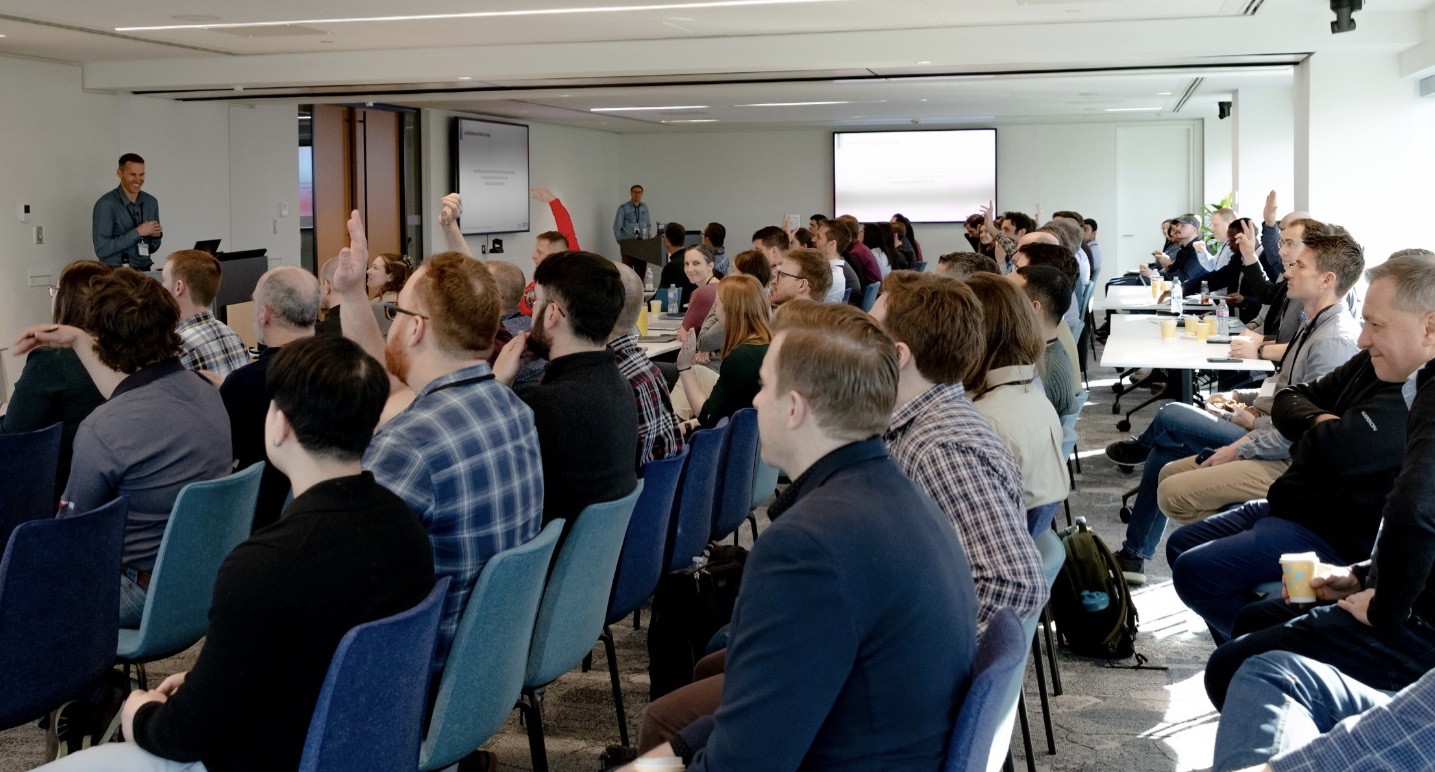
Last week in Calgary, over 80 geohazard professionals representing more than 30 pipeline operators came together for the 18th Annual BGC Geohazard Symposium X Cambio User Group — both in person and online.
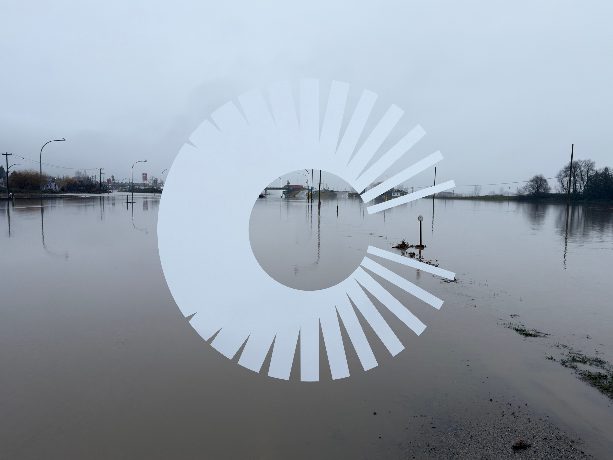
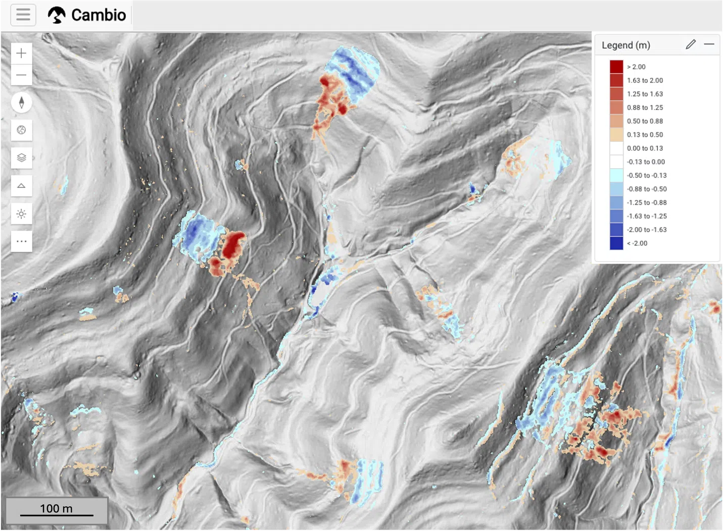
This winter, atmospheric rivers delivered intense rainfall across the West Coast of North America, pushing already saturated landscapes past critical thresholds.
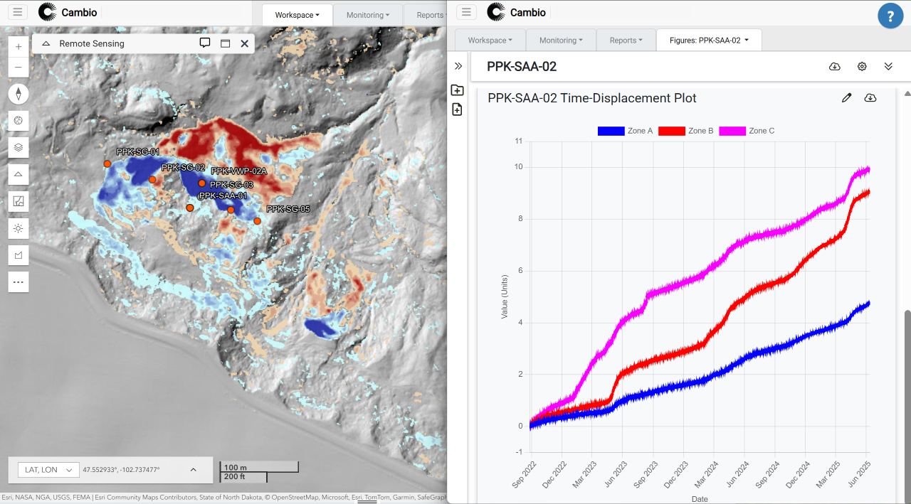
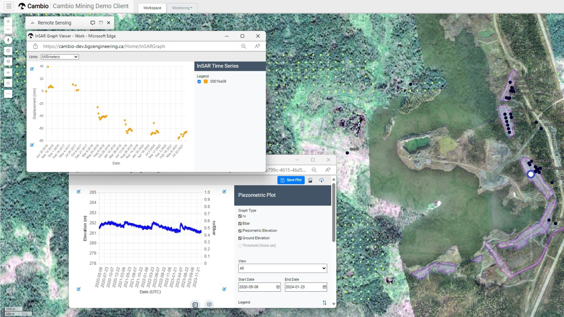
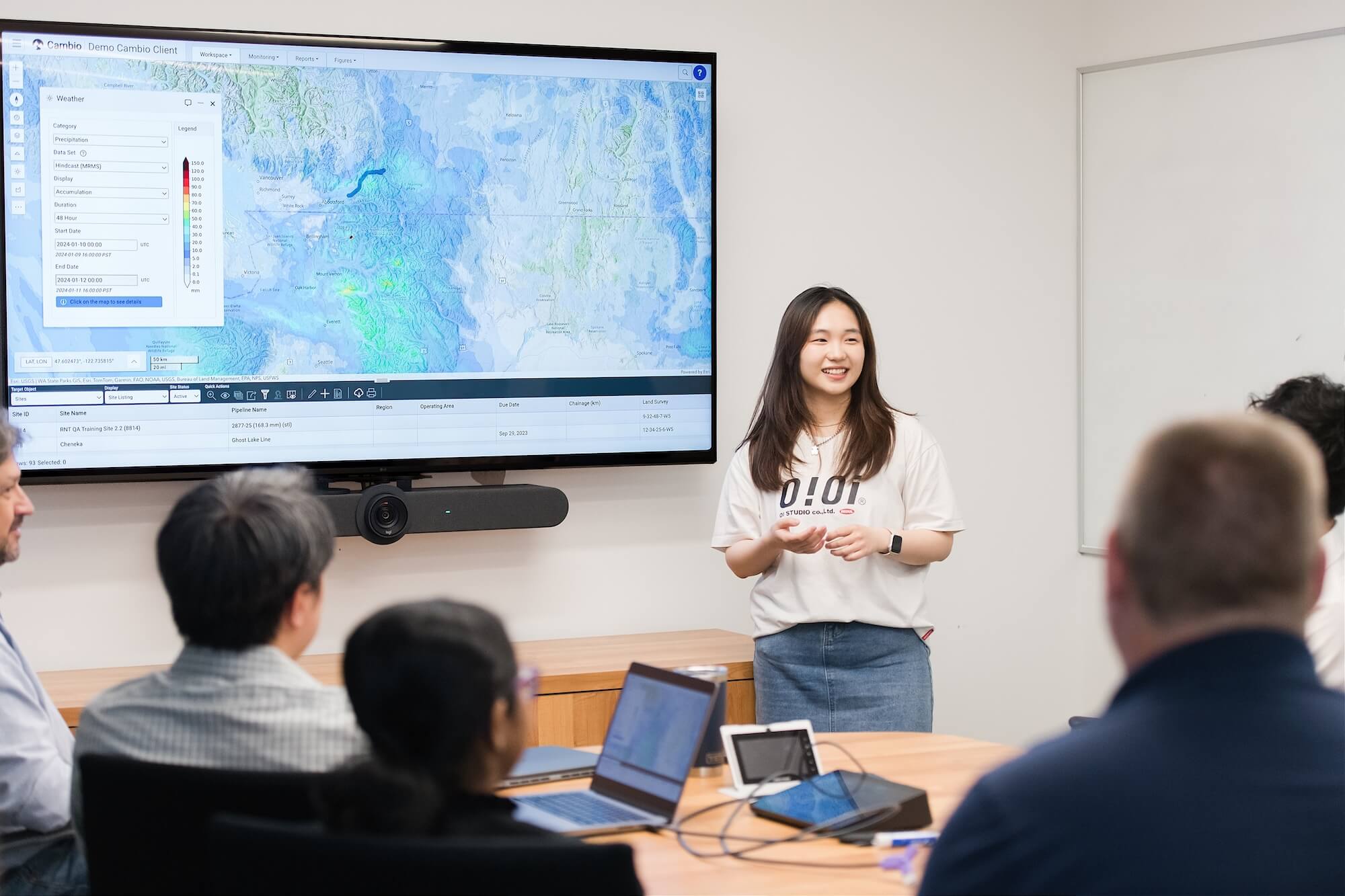
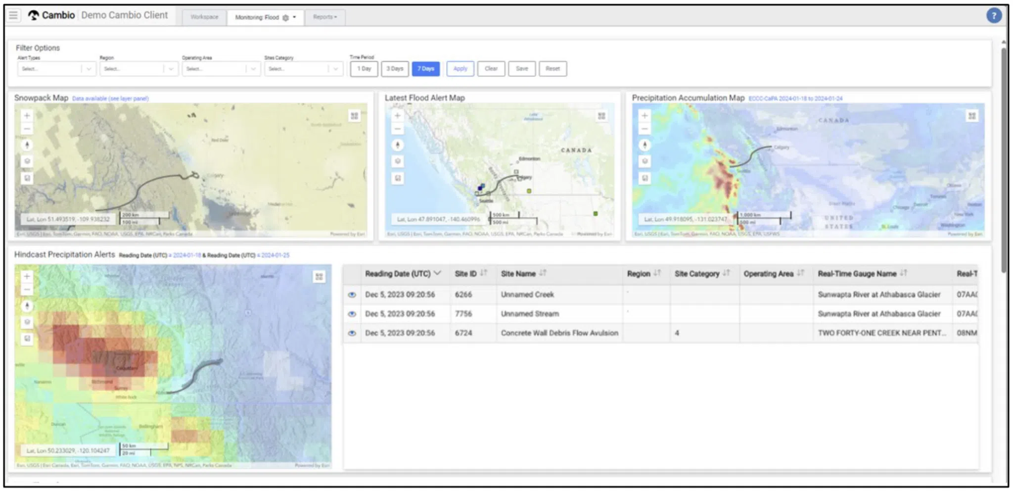
Instrumentation data is easy to collect—but hard to interpret when it’s scattered and out of context. Cambio’s instrumentation tools help infrastructure and geotechnical teams move beyond data management by reconnecting measurements to the physical, operational, and risk context of the asset.
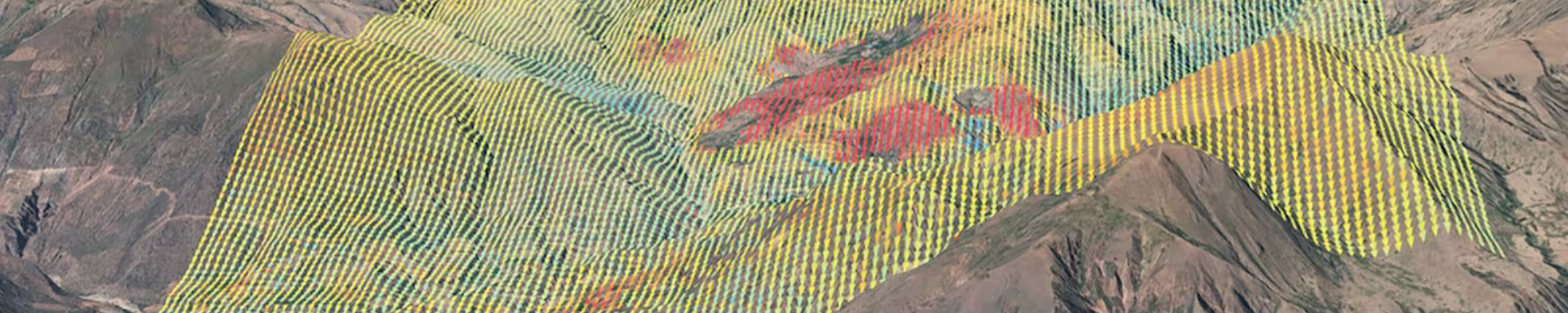
For years, pipeline integrity teams have known there’s something valuable buried in Inertial Measurement Unit (IMU) data — but actually extracting that value has been another story.
The mining industry’s relationship with data—especially instrumentation data—has evolved dramatically. We’ve gone from craving more data to design and monitor facilities, to having too much data without effective ways to utilize it.
Over the past several years, the Red Chris team, supported by BGC Engineering and Cambio Earth, has implemented a geospatial digital knowledge base to strengthen that understanding.
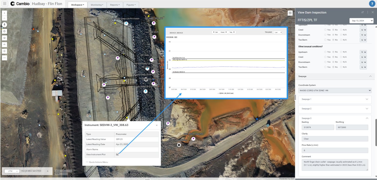
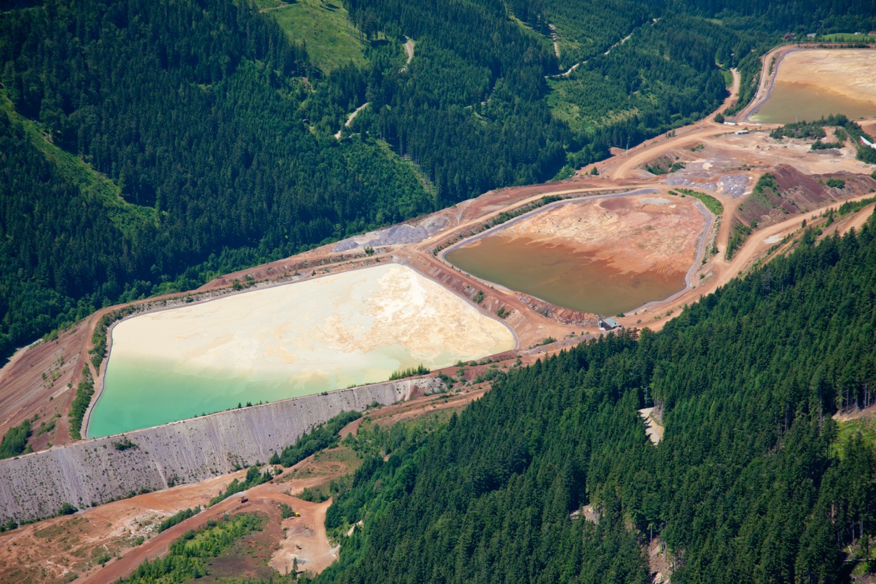
At Hudbay’s Flin Flon Tailings Impoundment System (FFTIS), BGC Engineering and Hudbay partnered with Cambio Earth to explore how a geospatial digital knowledge base can transform dam safety inspections (DSIs).
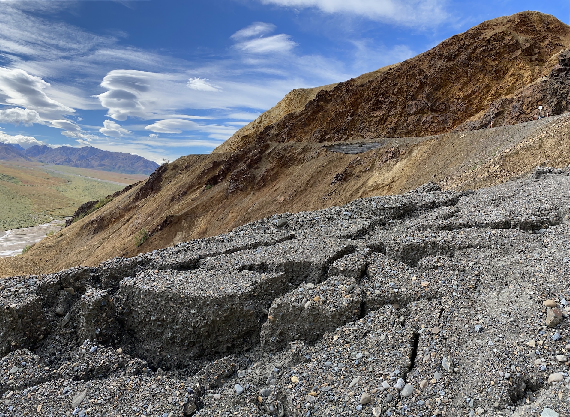
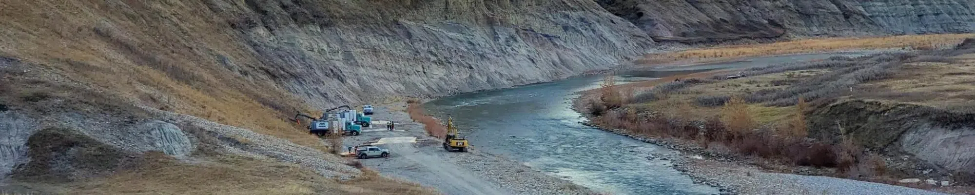
In June 2022, a catastrophic rain-on-snow event swept through Yellowstone National Park, washing away critical roads, severing community links, and forcing engineers to rethink what it means to rebuild in landslide terrain.
In Part 1, we explored how siloed data can undermine tailings storage facility (TSF) monitoring, and how platforms like Cambio are enabling continuous insight through integrated, geo-referenced digital twins. Now in Part 2, we focus on implementation—what it takes to modernize your monitoring workflows, and the real-world results that follow.
Mine owners, Engineers of Record (EoRs), and geoscientists are embracing integrated instrumentation and geospatial tools to break down data silos. The result is real-time situational awareness, a dynamic digital knowledge base for data-driven decisions, and safer, more efficient tailings operations—delivering continuous insight from prefeasibility through construction and into closure.
This past March, the 17th annual BGC Pipeline Geohazard Symposium x Cambio User Group brought together 101 geohazard rockstars from 38 pipeline companies across Canada, the U.S., and Peru.
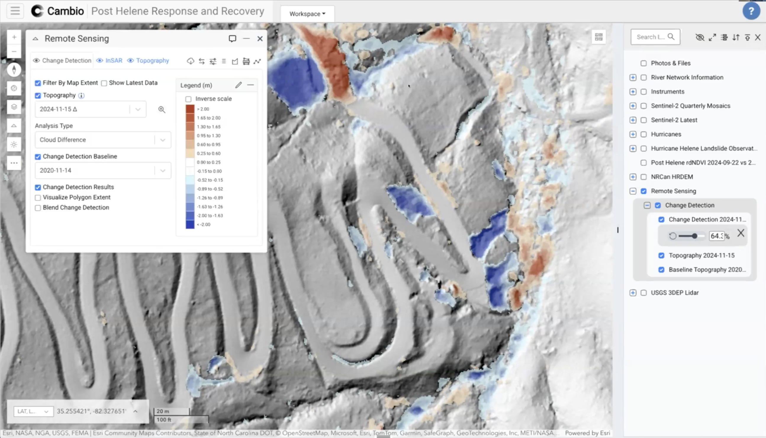
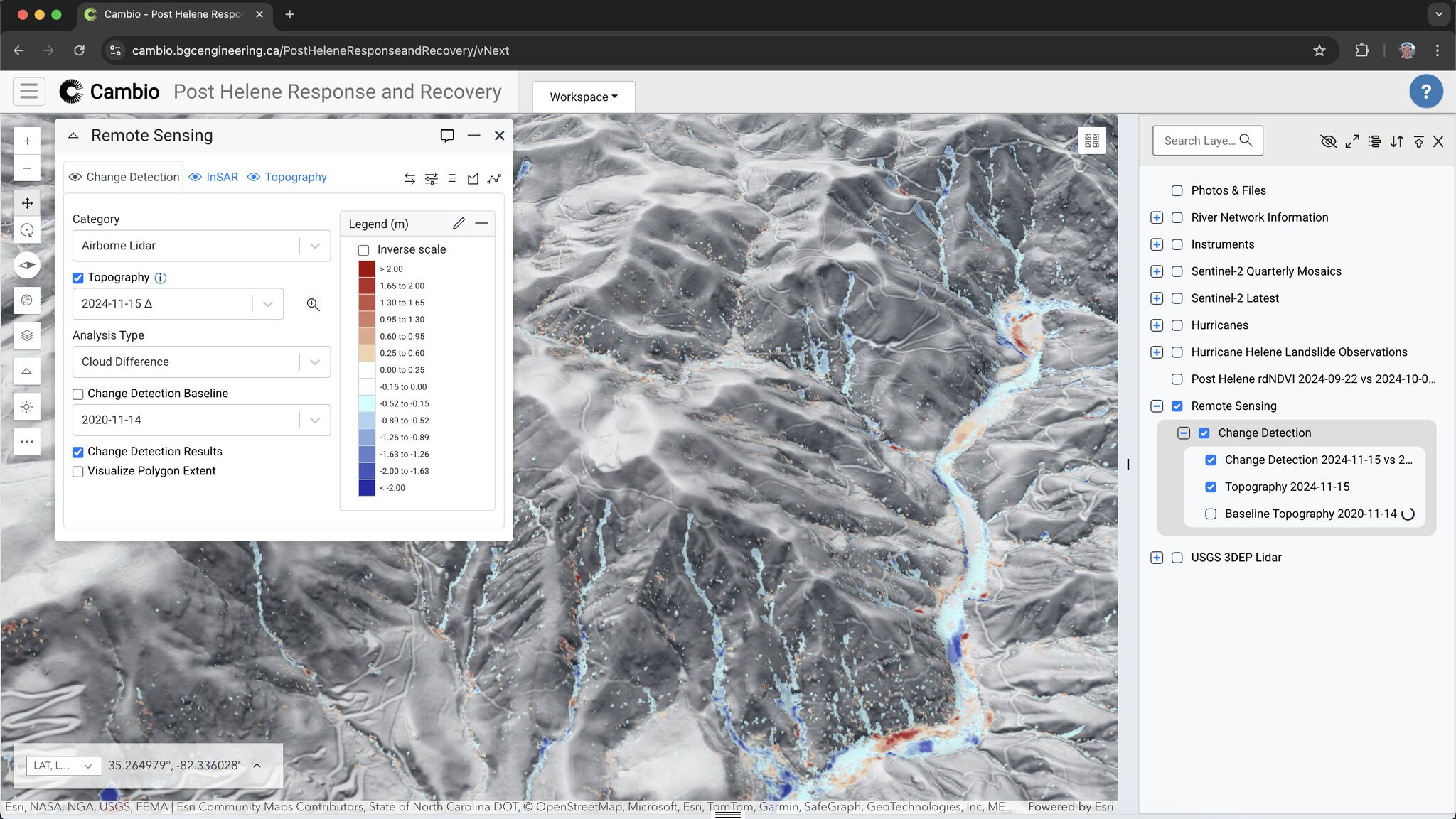
This case study examines the potential implementation of Light Detection and Ranging (lidar) technology in rapid disaster response following Hurricane Helene in September 2024.
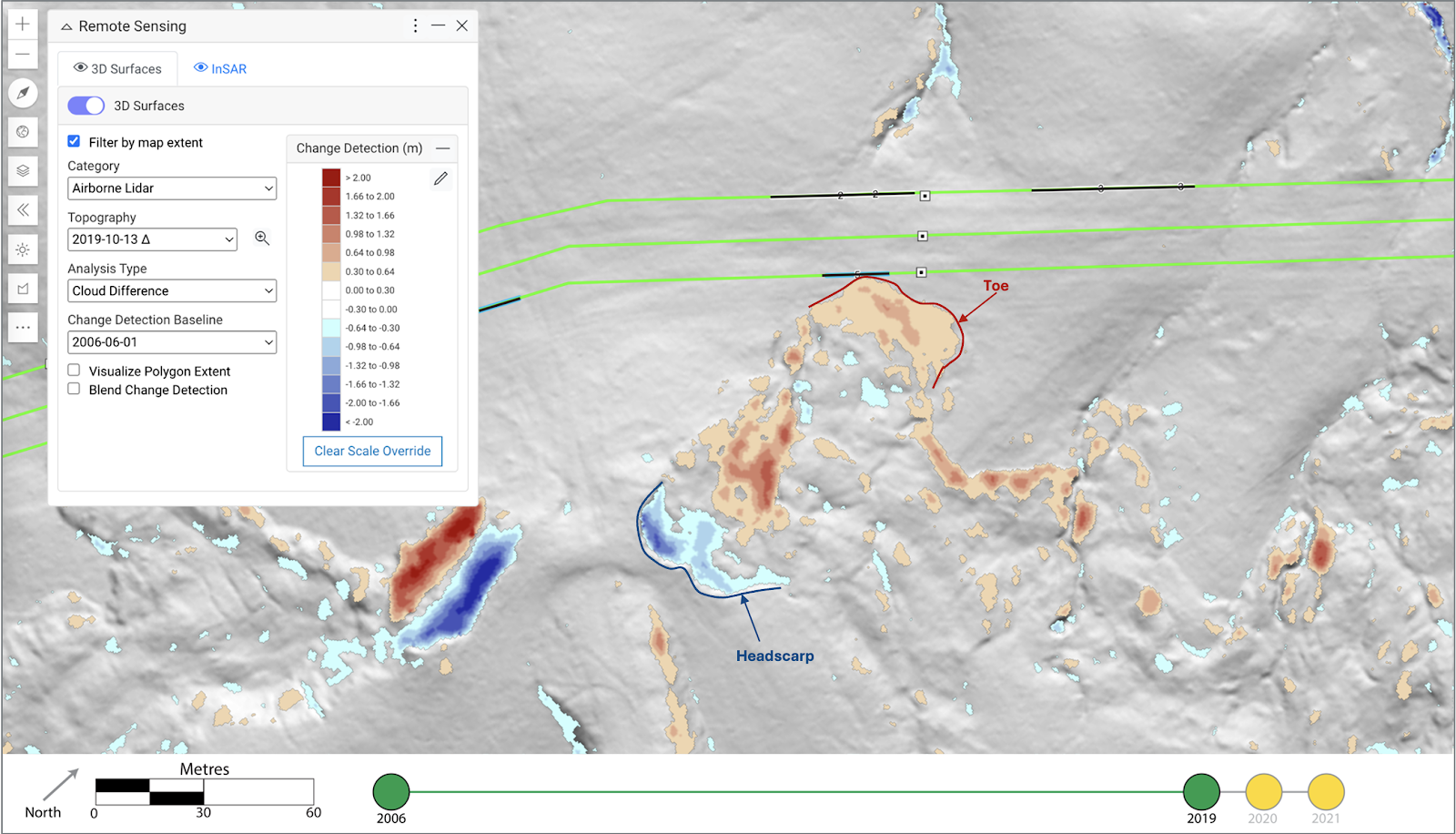
Geohazards like landslides are a major threat to pipelines. Discover how expert Dr. Corey Scheip and Cambio are leveraging cutting-edge tech like lidar and InSAR to detect and monitor these threats, ensuring the safety and integrity of our pipeline infrastructure.
At the PPIM Conference in January 2025, Joel Van Hove presented new research on how inertial measurement units (IMUs) can be used to detect and prioritize pipeline segments at greatest risk from landslides.
This year’s 2024 R&D Symposium, co-hosted by BGC and Cambio Earth, was a seismic event—not just for the movers and shakers in earth science and engineering, but for innovation itself.
We caught up with Sarah Newton, Head of Product & Customer Success and Senior Geological Engineer, and Chad Sutherland, Senior Product Manager, last week to get some insights on what they experienced at the show.
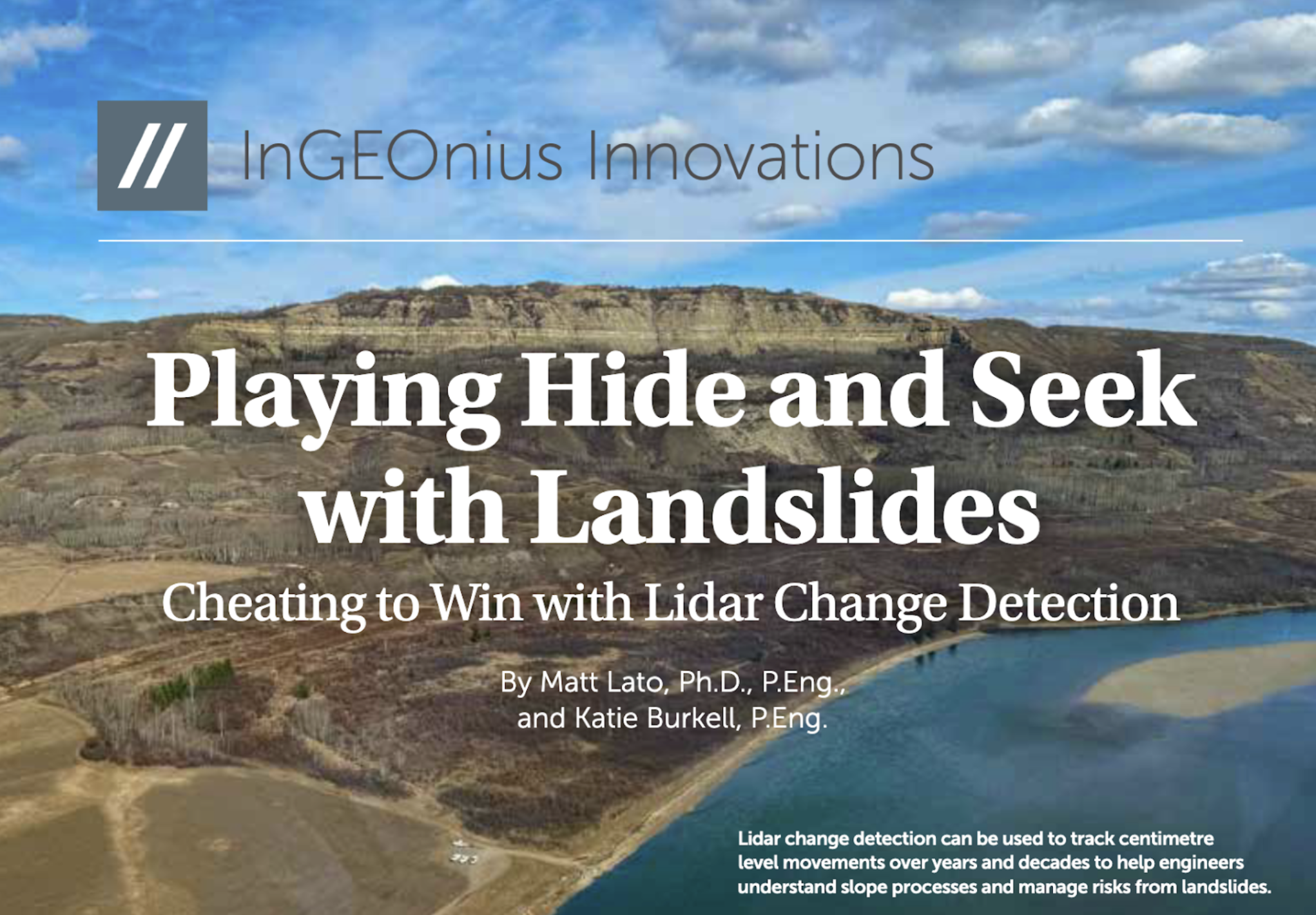
BGC Engineering's Matt Lato, Ph.D., P.Eng. and Cambio Earth Systems' Katie Burkell, P.Eng were featured in the InGEOnius Innovations column of Geostrata Magazine's August edition.
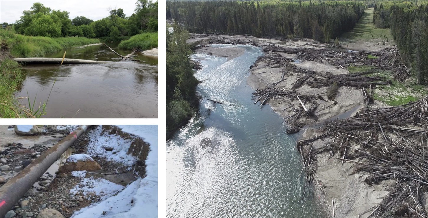
The Landslide EventIn late July 2022, a series of convective storms in Eastern Kentucky resulted in up to 400 mm of rainfall over a six-day period, with a maximum 24-hour precipitation accumulation exceeding…
Are you considering or currently using airborne lidar to manage the geotechnical risk to your critical infrastructure? Access the webinar to learn more.
In April 2024, Alex Baumgard of BGC Engineering presented a paper written by him and Katie Burkell of Cambio Earth Systems titled "The Use of Advanced Geohazard Management Software to Incorporate Real-Time and Near-Time Data into Decision Making" at the 19th Pipeline Technology Conference (PTC) in Berlin.
Cambio Earth was recently featured in an article for The Globe & Mail, "Integrated data solution for safeguarding critical infrastructure and the environment."
Our Sr. Product Manager, Katie Burkell, presented at Geo-Congress on the topic of geotechnical asset management challenges in the Pipeline, Transportation, and Mining sectors.
.svg)
%20(3).png)
.jpg)
%20Large.jpeg)

.png)


.jpeg)

.jpeg)
.png)

.png)