IMU: A Critical Tool for Pipeline Landslide Risk Management
.png)
Ensuring pipeline integrity in landslide-prone terrain requires vigilant monitoring and risk mitigation. Landslides—especially those that move slowly and imperceptibly over time—pose a significant threat to buried pipelines, with potential consequences including ruptures, environmental impacts, service interruptions, and safety incidents.
At the PPIM Conference in January 2025, Joel Van Hove, Senior Geotechnical Engineer at BGC Engineering, presented new research on how inertial measurement units (IMUs) can be used to detect and prioritize pipeline segments at greatest risk from landslides.
Trenching vs. Horizontal Directional Drilling: Performance in Landslide Zones
When pipelines traverse unstable ground, they are typically installed using either trenching or horizontal directional drilling (HDD). Trenching involves excavating a ditch several meters deep, placing the pipe, and then backfilling. It provides a direct and mechanically stable installation method.
HDD offers a non-intrusive alternative, using guided drilling to place the pipeline through a narrow curved borehole that can extend up to 70 meters below the surface. This method is particularly useful for avoiding surface obstacles such as rivers, roads, and geotechnical features. However, HDD-installed pipelines are statistically more vulnerable to landslide-related strain and damage. Research has shown that HDD segments are approximately 15 times more likely to fail in landslide terrain than trenched pipelines.
Understanding Why Deeply Buried Pipelines Are More Susceptible
Although steel pipelines are mechanically robust, those buried at significant depth may experience amplified strain due to the relative stiffness of surrounding soils. In landslide zones, even small ground displacements at depth can impose large stresses on HDD segments. This is particularly problematic for slow-moving landslides, which can deform pipelines over extended periods without obvious surface indicators.
IMUs as a Monitoring Solution
Inertial measurement units (IMUs) offer an effective means of detecting and monitoring pipeline strain related to ground movement. These tools combine accelerometers and gyroscopes in a pigging device that travels through the pipeline, capturing detailed 3D profiles of pipe curvature and alignment.
IMU monitoring provides several advantages:
- Widespread Adoption: Many operators already use IMU data to validate pipeline alignment and depth of cover.
- Pipeline-as-Sensor Approach: The pipeline effectively becomes a sensor, enabling estimates of burial depth and potential interactions with ground movement.
- High Sensitivity: IMUs can detect subtle deviations in alignment, flagging areas where bending strain is accumulating—well before damage occurs.
Managing IMU Drift and Improving Accuracy
One technical challenge with IMU-based inspection is "drift"—the accumulation of positional error over long distances. For instance, over 1,000 meters, drift may introduce an error of approximately 0.5 meters. While not large enough to invalidate results, it can affect positional accuracy.
To mitigate this, operators use surface-based control points (tie points) with known coordinates. These allow recalibration of the IMU’s trajectory, improving geospatial precision.
Integrating IMU with Other Remote Sensing Technologies
The effectiveness of IMU data increases significantly when combined with other complementary technologies:
- Lidar Change Detection (LCD): Provides detailed surface deformation patterns over time.
- InSAR (Interferometric Synthetic Aperture Radar): Monitors sub-centimeter ground displacement using satellite imagery.
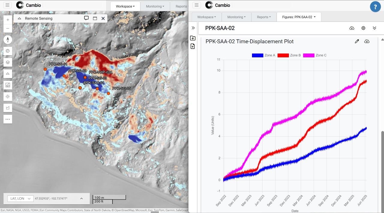
A recent BGC Engineering case study in the Columbia River Gorge demonstrated the value of this integrated approach. By using IMU, LCD, and InSAR together, engineers monitored deformation across an HDD segment for over seven years. This multi-source data enabled detailed risk characterization and informed long-term maintenance planning.
Risk-Based Prioritization of HDD Pipelines
Van Hove’s research suggests that operators should prioritize HDD pipeline segments located in landslide-prone terrain. Although HDD segments typically comprise a small fraction of any pipeline system, they are disproportionately associated with high-consequence failure risks.
By using IMU data, operators can:
- Identify and track deformation along HDD segments.
- Evaluate strain patterns indicative of external ground movement.
- Allocate resources efficiently to mitigate risks.
- Prevent failures through early detection and intervention.
ICYMI at PPIM 2025
In case you missed the session at PPIM 2025, you can view Joel’s paper here.
For additional information or support implementing IMU-based workflows, contact the Cambio Earth team.
.svg)

%20Large.jpeg)

.png)